Stories
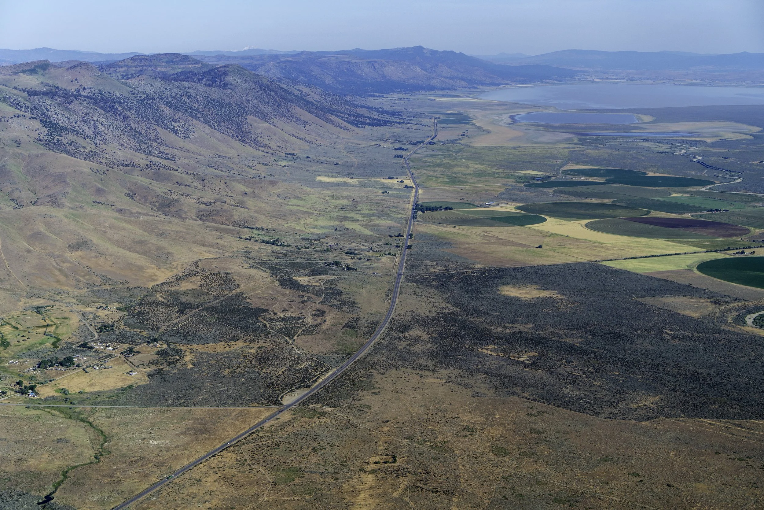
Protecting Private Working Lands: Essential Strategy for Wildlife Connectivity in Northeast California
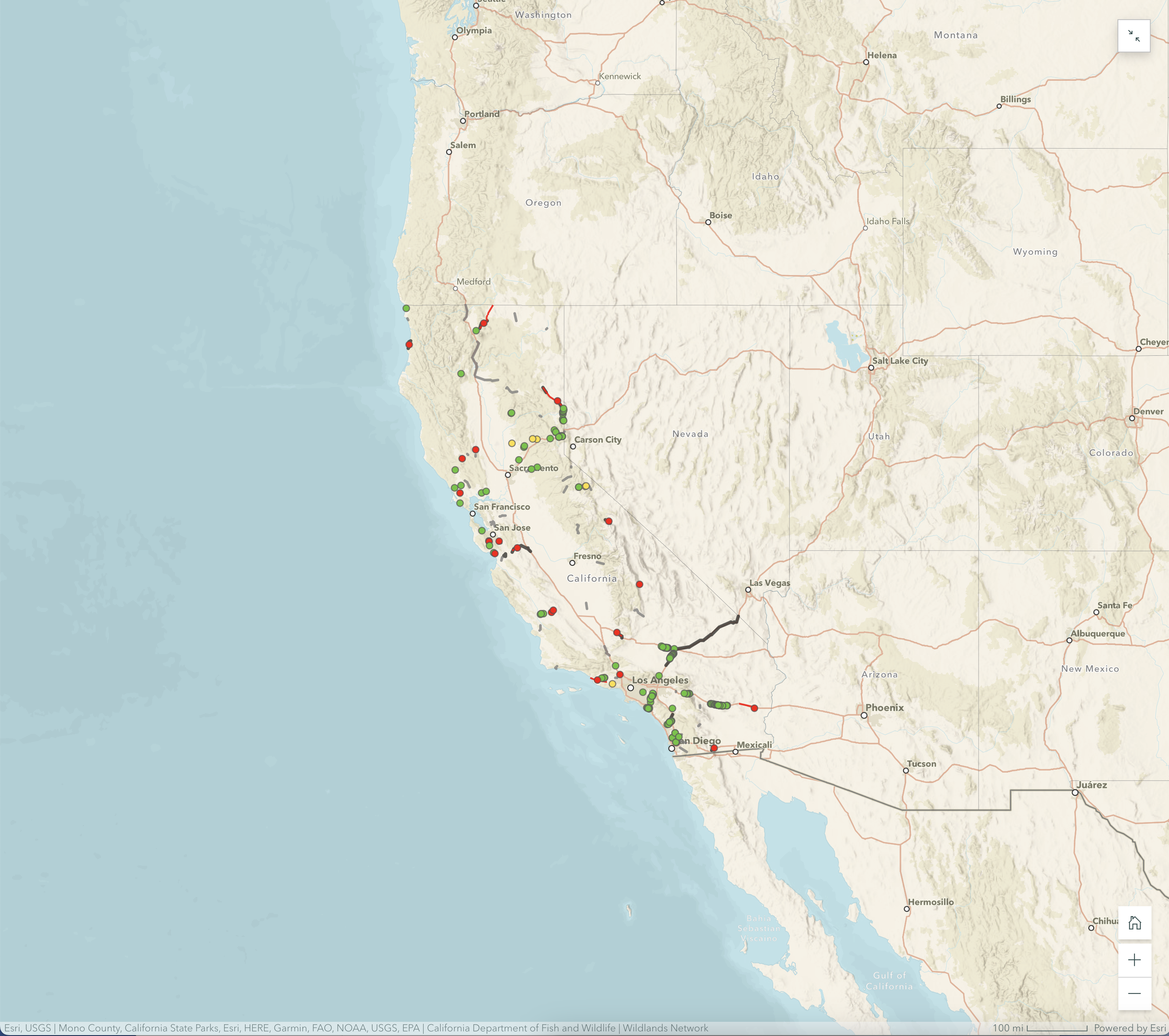
Wildlands Network Creates the First Comprehensive Map of Wildlife Crossings Across California
Today, Wildlands Network unveiled an interactive map of wildlife crossings across California, presenting the first-ever comprehensive database of crossings across the State. Developed in collaboration with the California Department of Transportation and other road ecology partners, this tool will enhance efforts to reconnect vital wildlife habitats.

Mapping Mexico: Telling Stories Untold
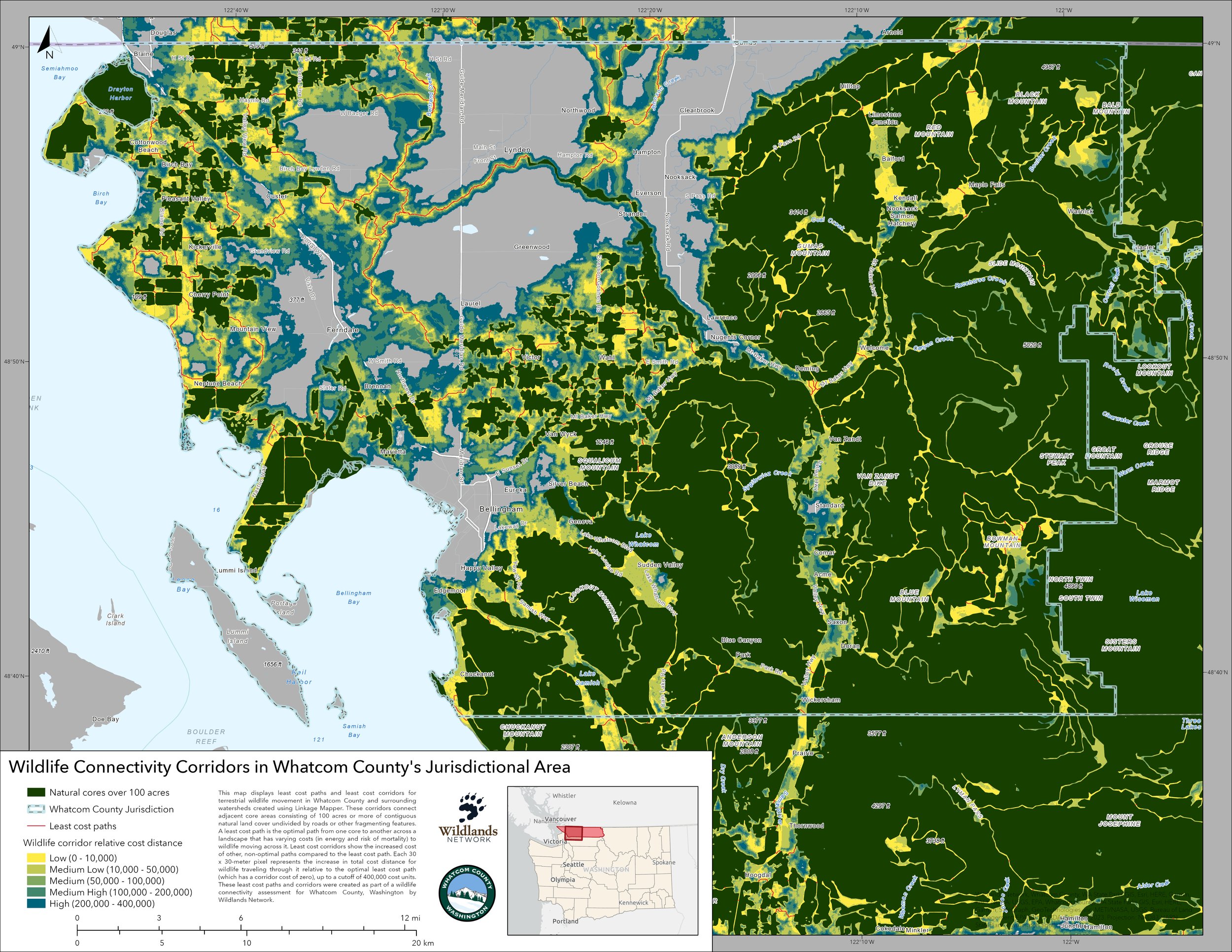
Mapping the Continent: GIS Connectivity Modeling with Alex Vanko