Utah Development and Wildlife: A Planning Framework for Coexistence
Utah is one of the fastest-growing states in the country and home to some of the West's most celebrated wildlife. Mule deer, elk, and pronghorn depend on connected landscapes to complete seasonal migrations, find food, and survive harsh winters. As cities and counties expand into those landscapes, the decisions planners make today will determine the future of that coexistence.
Recent legislation is moving in the right direction. HB 412, sponsored by Rep. Doug Owens and Sen. Derrin Owens, now requires solar and wind projects to consult with the Utah Division of Wildlife Resources before obtaining permits, ensuring wildlife considerations are part of the conversation before projects break ground. Wildlands Network was proud to serve as one of the bill’s primary advocates throughout the session.
HB 431, sponsored by Rep. Scott Chew, creates the Wildlife Crossing Account within the Transportation Investment Fund, setting aside $2 million annually for wildlife crossing and habitat connectivity projects. Having predictable funding is essential for leveraging federal matching dollars, coordinating long-term transportation planning, and proactively reducing costly wildlife-vehicle collisions that threaten Utah’s public safety and wildlife heritage.
But roads and energy development are just two pieces of a much larger puzzle. The decisions made by local planners are critical to shaping how Utah manages wildlife habitat and urban growth. General Plans, zoning ordinances, and transportation documents drafted by municipal and county planners are where the real work gets done. To help those planners act, Wildlands Network developed the Planning for Habitat Connectivity toolkit, a practical Utah habitat connectivity planning resource for integrating wildlife into local planning. We sat down with the toolkit's author to learn more.
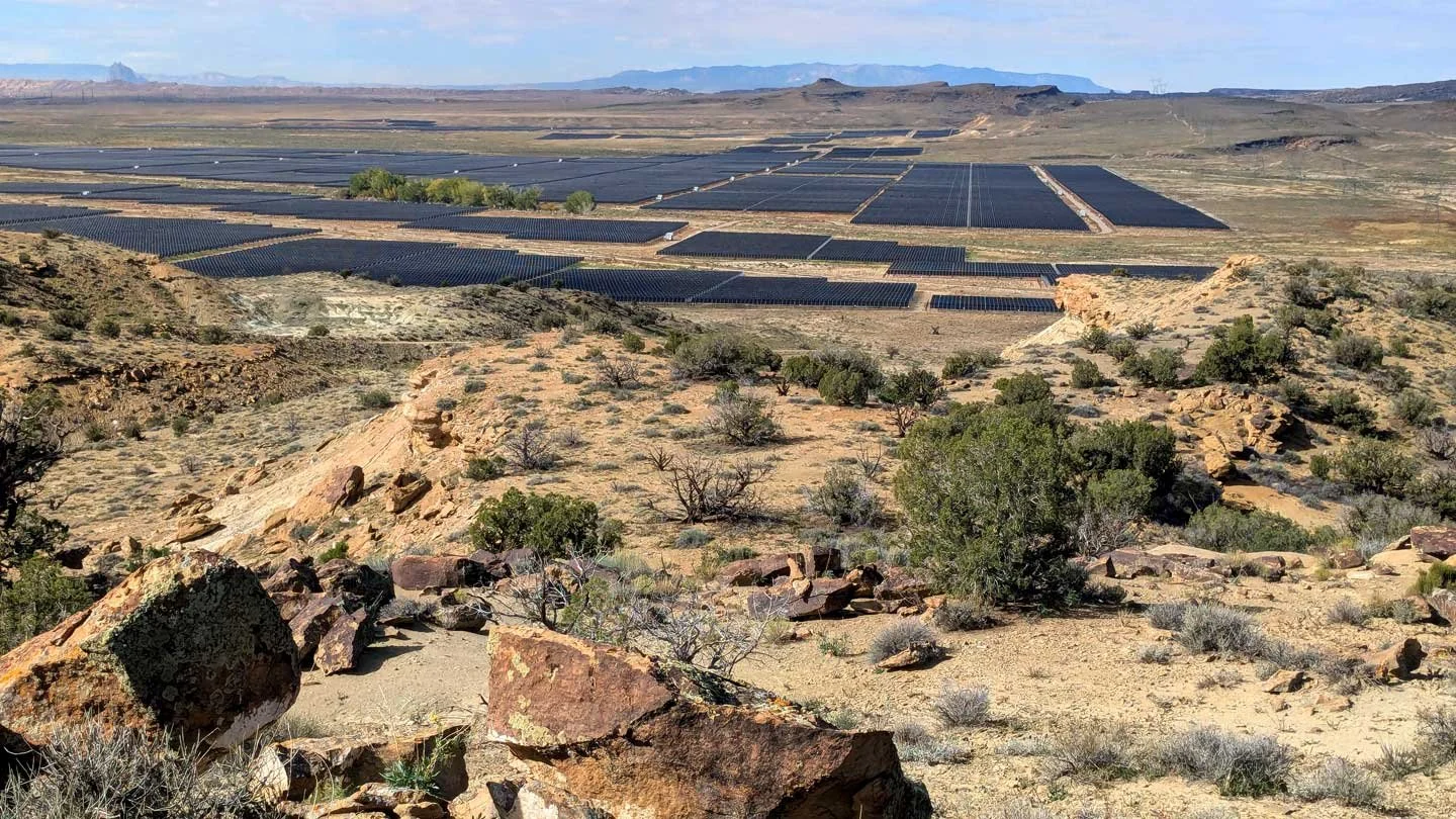
Solar panels blanket a stretch of Utah's high desert, where energy development and wildlife habitat increasingly overlap.
Can you tell us a bit about the impacts of urban development on wildlife in Utah today?
Kasey Lindstrom: Utah is one of the fastest growing states in the country, and new housing, roads, and infrastructure are being planned and built in nearly every corner of the state. This growth brings significant benefits, but it also brings serious risks and pressures – especially where it overlaps with wildlife habitat. Animals that migrate, like mule deer, elk, and pronghorn, don’t recognize city limits or county boundaries. Rather, they move across the landscape along migration routes that have existed for generations. When movement corridors are disrupted by poorly sited or designed developments, roads, and fencing, the impacts are immediate: wildlife might be blocked from accessing seasonal habitat, pushed into smaller, fragmented, and less suitable areas, or funneled to cross busy roads, increasing wildlife-vehicle collisions.
What important wildlife habitat planning gaps does this toolkit address?
KL: Utah has made lots of progress when it comes to planning for wildlife at the state level, like HB 412 and HB 431. However, often, that thorough and thoughtful planning doesn’t trickle down to the local level. Many cities and counties are interested in supporting wildlife but lack the guidance on how to do so within existing planning frameworks.
Plus, as Utah continues to grow and develop, local governments will be asked to make difficult decisions about land use, infrastructure, and community design. This toolkit is intended to make those decisions easier – by providing a framework that communities can adapt to their own needs, interests, and capacities.
Who is this toolkit written for, and how is it meant to be used?
KL: This toolkit is mostly intended for local governments – city and county planners, planning commissioners, elected officials, and staff who are shaping how their communities grow and develop.
It’s meant to be flexible and accessible, so communities with varying levels of interest, resources, and capacity can incorporate wildlife considerations into their planning documents at the scale that makes the most sense for them.
It’s also designed to be a resource for partners – like state agencies and nonprofits – who are working alongside local governments and want to support wildlife-friendly planning in a coordinated way.
How can a small municipality with limited resources get started with wildlife-friendly planning?
KL: It doesn’t require a huge budget or extensive staff capacity to get started. Planning with wildlife in mind doesn’t have to begin with major investments. Rather, it can start with small, strategic decisions that shape how a community grows over time.
Across Utah, communities of all sizes have already shown that it’s possible to support wildlife movement while still growing and developing. Towns as small as Boulder, Utah - population roughly 260 - have already begun community conversations about incorporating wildlife considerations into their planning documents. A really strong first step is simply acknowledging the importance of wildlife in a General Plan.
Also, small communities can focus on a few high-impact, low-cost actions, like taking advantage of existing state data to identify and map important habitats, avoiding development in the most sensitive areas when possible, and incorporating basic design considerations, like wildlife-friendly fencing, into projects over time.
Equally important, partnerships are key. Communities don’t have to tackle this work alone. Many state agencies and nonprofits, including Wildlands Network, can provide data, technical assistance, and even funding support. Ultimately, starting small and early and building incrementally can still support wildlife movement and connectivity across the landscape.
Eagle Mountain became the first city in Utah to implement a Wildlife Corridor Overlay Zone. What made their approach so groundbreaking, and what can other communities learn from it?
KL: Eagle Mountain really is a standout example of what it looks like to plan with wildlife in mind. This Wildlife Corridor Overlay Zone is so groundbreaking because it extends beyond simply identifying important habitat and actually embeds wildlife considerations into the development process. This Zone recognizes and protects an important movement corridor used by the resident mule deer herd that moves through the city by triggering additional steps for new development.
One of the biggest takeaways is that protecting wildlife doesn’t have to mean stopping growth and development. Instead, Eagle Mountain shows that communities can be proactive – shaping where and how growth and development happen so that it supports both residents and wildlife. It’s a model case study for how local governments can translate wildlife science into on-the-ground planning and policy decisions.
What do you hope Utah looks like in 20 years if communities start adopting the recommendations in this guide?
KL: In 20 years, success would look like a Utah where growth and development and wildlife are no longer in conflict but are planned for together from the very beginning rather than a reactionary afterthought.
Ideally, wildlife considerations would be a standard part of the local planning process. Regardless of size, communities across the state would have the resources to make decisions that support wildlife movement and connectivity alongside continued growth and development.
Is your community ready to protect wildlife habitat through local planning? Download the Planning for Habitat Connectivity toolkit to get started.