Where the Wild Things Cross: How One Map Is Helping California Connect Habitats
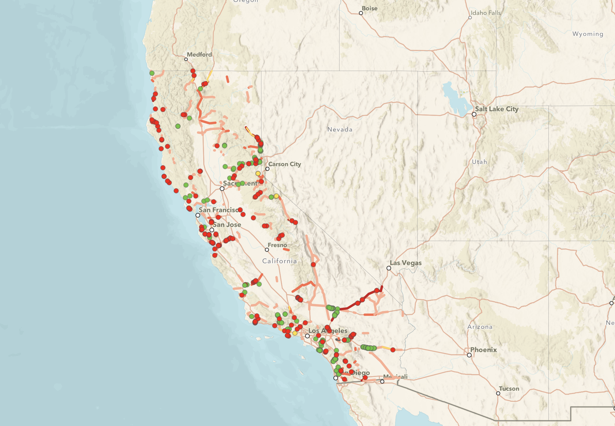
In 2023, Wildlands Network published a first-of-its-kind map of existing and planned wildlife crossings in California. Thanks to a recent update, the map now incorporates comprehensive information on wildlife crossing projects and the updated California Department of Fish and Wildlife priority barriers to wildlife across the state.
In this Q&A, Wildlands Network California Program Coordinator Gillian Roy describes how this map and accompanying StoryMap offer insights for the public, land managers, and more who are advocating for wildlife connectivity throughout the state.
The map was first published in 2023. What was the need or desire for creating a map like this one?
Gillian: Before we created the map in 2023, there was no single, comprehensive source showing where wildlife crossings had been built or were currently being planned in California. As momentum around wildlife connectivity and crossing construction grew, it became increasingly important to have a tool that could track and visualize this progress. The map shows that crossings are being planned and implemented across the state — not just in a few high-profile locations.
Beyond simply tracking history, the map is also a planning resource. By compiling these projects in one place, it helps land managers and planners see the broader connectivity picture so that new infrastructure or development doesn’t inadvertently undermine the benefits of nearby crossings.

Construction is now underway for the U.S. 97 wildlife overcrossing in Northern California. Photo by Wildlands Network
There are some new elements to the map this year, including the addition of a statewide dataset from the California Department of Fish and Wildlife (CDFW) that identifies barriers to wildlife movement. What is the history of this dataset? Are there any notable trends or highlights in that data?
Gillian: In 2020, CDFW released its initial list of barriers to wildlife movement throughout the state. In 2022, it reviewed and updated the list of barriers in each region of California, identified additional wildlife barriers, and identified two top priority barriers in each CDFW region.
In 2024, CDFW further expanded the list of barriers to wildlife movement. This new dataset is now included in our wildlife crossing map. One of the biggest shifts is the sheer increase in the number of barriers represented. The dataset now recognizes over 200 wildlife barriers, up from about 150 in 2022 and 60 in 2020. The data also now goes beyond state highways to include additional obstacles like county roads, railroads, high-speed rail alignments, and water infrastructure, such as Los Banos Canal and Coachella Canal, which can be just as disruptive for wildlife as roads in the State Highway System.
The 2024 CDFW barriers to wildlife movement dataset also now includes additional information about each barrier segment. This expansion reflects both improved data analysis and increased staffing capacity, giving us a more complete picture of where animals are being blocked. It highlights not only the scale of the challenge but also the progress in building the knowledge base needed to address it.
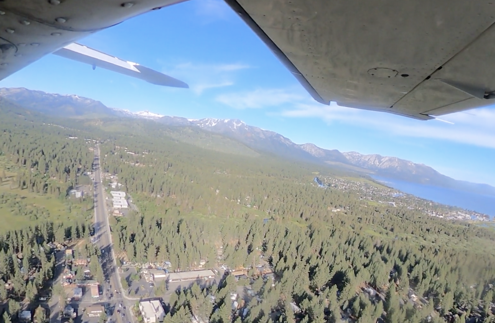
One new CDFW priority wildlife barrier—Pioneer Trail Road in South Lake Tahoe—as seen from above. Photo credit: EcoFlight
The map also highlights some additional wildlife crossings that are now under construction or being planned since the map's initial publication. Are there any especially notable crossings in the works?
Gillian: There are several exciting new projects now in the works, and the StoryMap provides detail on some of them. For example, Caltrans is constructing Northern California’s first wildlife overcrossing bridge on U.S. 97 in Siskiyou County, and the Lassen County Transportation Commission is leading the planning and design of a wildlife overcrossing on U.S. 395.
Among the most notable are crossings that reflect Caltrans’s newly identified priorities under the California Legislature’s Safe Roads & Wildlife Protection Act (AB 2344). It requires Caltrans to plan and prioritize connectivity projects statewide. The inclusion of these crossings shows how quickly the policy is translating into action. It also underscores how tools like this map can help the public and partners track implementation of laws designed to improve safety for both wildlife and drivers.
The legislation passed in 2022 and was authored by California State Rep. Laura Friedman and co-sponsored by Wildlands Network and the Center for Biological Diversity.
How do you hope the map/database will be used?
Gillian: At the broadest level, the map is a public awareness tool. It helps people see where wildlife crossings exist and why they matter, making the concept of connectivity more tangible. But it’s also meant to be a practical resource for planners and agencies at the county, city, and state levels, ensuring that current and future crossing infrastructure is considered as decisions about land use and infrastructure are made.
Just as importantly, the map helps identify where crossings don’t yet exist. By highlighting those gaps, it can guide attention toward priority areas and ensure that critical landscapes are not overlooked in future planning and investment.

Site visit to potential wildlife crossing locations on US-395 with California state agency staff. Photo by Wildlands Network
How can people share suggestions for map improvements?
Gillian: We’re always adding to the crossing map database. If you have information about a crossing that isn’t included in the database, please fill out this form or email gillian@wildlandsnetwork.org.